
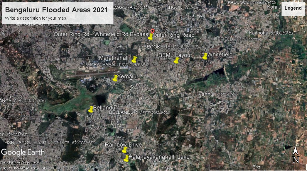
- Where has it flooded
2. Why has it flooded?
Why here? Why now?
a. Elevation
The low-lying areas (green & blue) have flooded first.
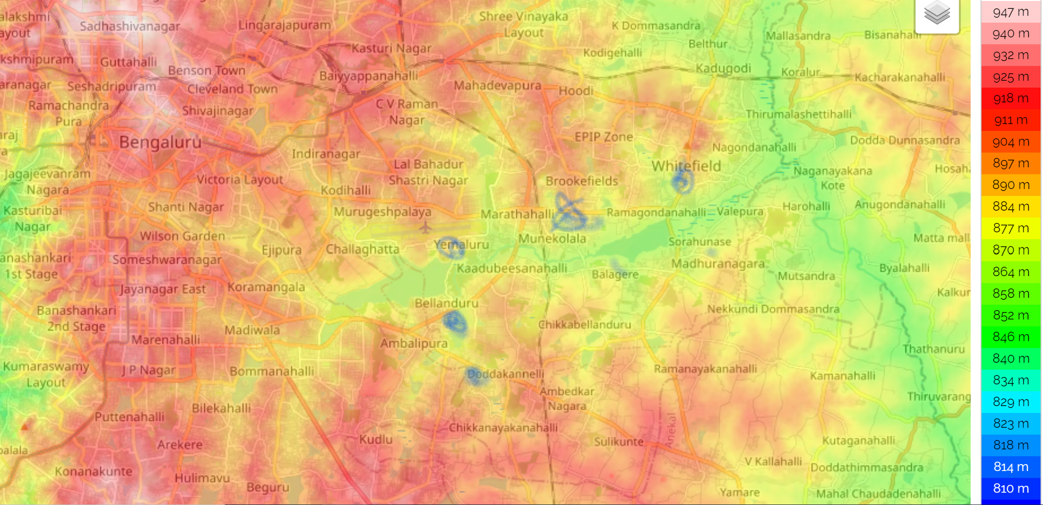
Moreover, areas subject to the highest flooding were often the lowest lying within a vicinity. Naturally, water flowed into them.
b. Land-use change – i.e., building over lakes/concretization/ blocking channels
Over time, many of the lakes and their surrounding areas in Indian cities have morphed into neighbourhoods. So too with Bengaluru. Many of the developments/ offices often developed on lake/buffer zones.
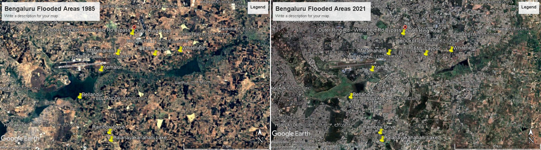
In 1985, most of these neighbourhoods were fields/ lake buffer zones. Today they are densely built up. This creates two problems: a field allows some rainwater to percolate underground. Building over a field with concrete means a greater proportion of rainwater “runs off”. Second, having a lake in a low lying area allows run off water from the surrounding area a place to accumulate. But when you replace lake with house, its the house collects that runoff water and floods.
The biggest casualties in land use change in cities are the connecting channels between lakes. These allow the “excess” water in a neighbourhood/lake to flow into a downstream lake. Sadly in most tank systems in India, Bengaluru included, such channels have been encroached upon/ clogged up with solid waste or overloaded with sewage.
It’s a triple whammy: more runoff, runoff destinations have become houses/offices, and other avenues to channel away run offs have been weakened/eliminated.
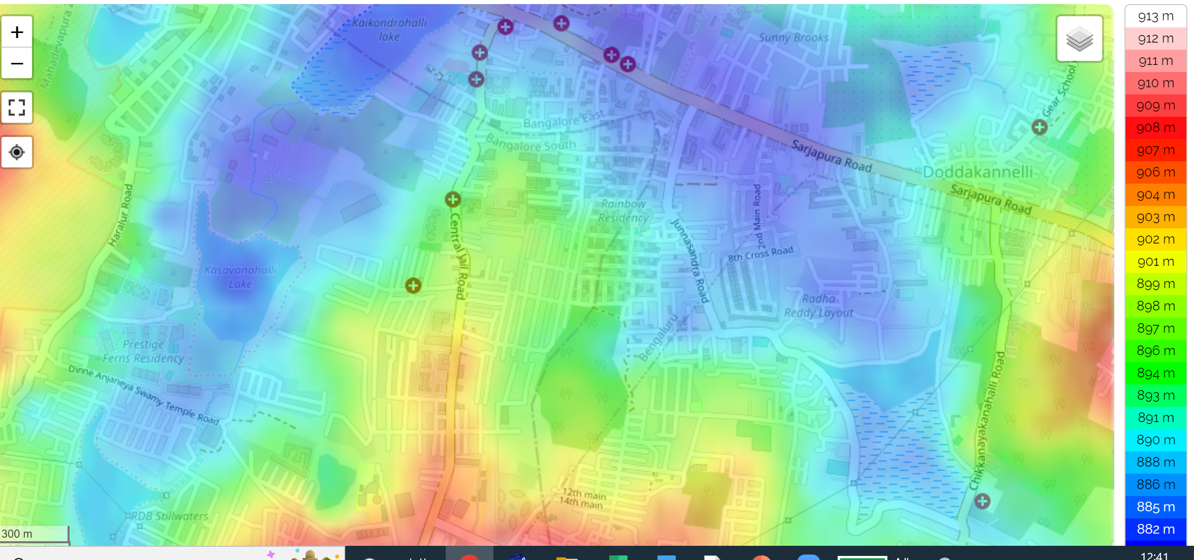
There are other micro-level points like roads altering the slope like in the case of Sarjapur Road, adding to the mess.
c. Lack of maintenance of tanks (desilting/ declogging drains etc)
There are reports of lakes being full in Bengaluru resulting in rains causing overflowing and thus flooding. Two points: Bengaluru has far fewer lakes than it did before. Indeed, a 2015 CAG report says:
The extent of the lake area varied in different records indicating reduction in lake area over a period of time. This was mainly due to grant of lake area for construction of roads; infrastructure and residential layouts; and change in land use. Also, encroachment of lake area caused choking/blocking of catchment drains, loss of foreshore area and wetland thereby leading to shrinkage in water spread area
Fewer and smaller lakes, more water and sediment load (including sewage), clogged channels – is it surprising lakes flood?
d. Rainfall
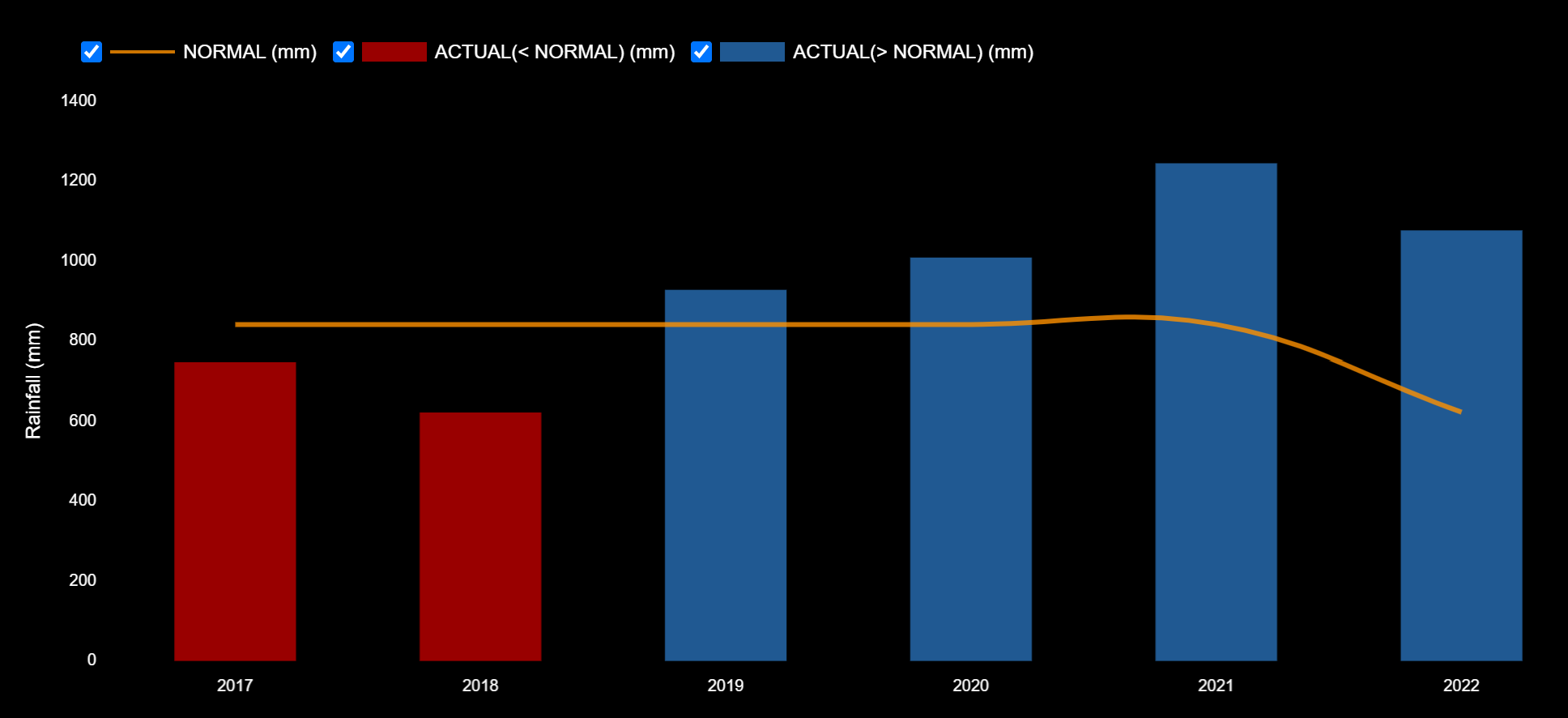
Bengaluru has had a couple of years of good rains filling up lakes and groundwater levels.
While this has been a wetter-than-usual August, Bengaluru’s biggest rain months still lie ahead.
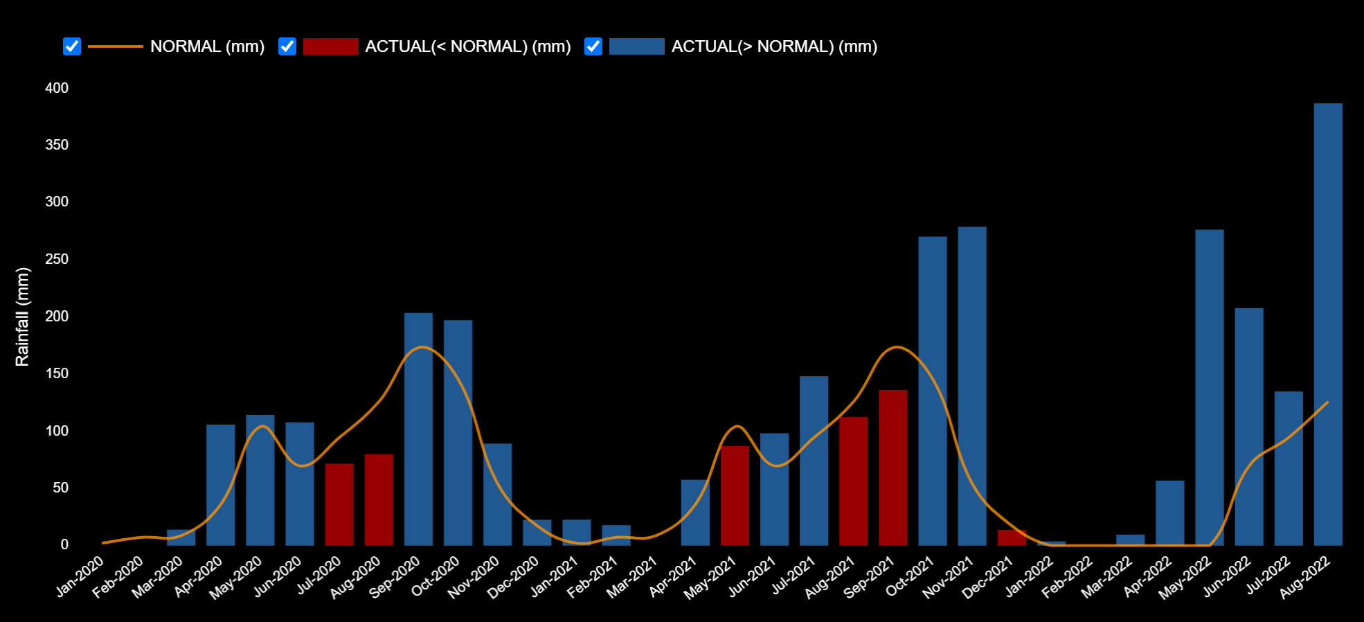
One reason for this is that this is a La Nina year (wetter-than-usual monsoons for India, generally), and the Madden-Julian Oscillation, a eastward moving “pulse” of rainfall that passes over the tropics. Currently the MJO phase is over the Indian Ocean, bringing rainfall to India. When this moves away, the rains should come down, especially since the Indian Ocean Dipole is currently negative, meaning lower rainfall in India’s winter.
More rain appears on its way in the next couple of days…stay safe.

All because of greedy politicians and builders we are ruining our ecology and look at the consequences
Nailed it but the story remain unchanged but only actors and directors change only
Floods and rains, give you warning to prepare yourself more.
Learn deep dredging ponds,lakes
Go crazy, on use JCB, make large dugouts, excavate and transport mud to near around farm prospect lands.
Old dugwells, maintain total area flow in them.. Happy Thoughts !